Thursday, July 29, 2010

Day 5 - Lee Vining to Hollister (via Yosemite National Park)

The Tioga Lodge was quaint and rustic. So rustic, when my roomy Drew took a shower last night, the shower head shot off and hit him in the chest. I decided to forego the resulting pressure wash treatment, since I'm out of clean clothes anyway. Phil and I decided to tour the park together since we seem to have a similar riding style and mindset for taking photos. The climb up to Tioga Pass at the entrance was close to 10,000 feet. Once in the park, we were greeted almost immediately to the vistas of granite faces with scattered alpine forests. Our first stop was Lembert Dome. It reminds me of Sugar Loaf Mountain, near Kyburz. We hiked up a ways towards Dog Lake to get a better view of the rock face. Curiously no dogs are allowed. It was a picture perfect day, despite the spectre of wildfires we were told of last night. There was not a cloud in the sky, and temperatures were pleasantly cool. A short stop on peaceful Tenaya Lake was teeming with swimmers and kayakers on the cold lake. Our next stop was Olmsted Point. It was a short hike to an outcropping of rock to view Half Dome. With my binoculars, I could see what looked like ants crawing up the rounded side of the peak, but it was a string of hikers climbing up a guide wire. The wind was whipping around the point where we were, and I can only image how windy it must be on top. It seemed like more than 100 hikers were visible. In the parking lot, we met another family riding motorcycles. Having a NC tag, and riding a scooter always makes for a great conversation starter. Once the Cable family, from Hollister found out we were on a charity ride, they immediately ponied up a cash donation. Thanks for your help. Mrs. Cable suggested we check out the Sequoias at Tuolumne Grove just before we turned onto Big Oak Road to leave the park. It wasn't exactly the 10 minute hike she said it was, but it was nice just the same. The pictures do not tell how huge these trees really are. Some as old a 3600 years, have somehow managed to survive fires, wind, winter, and man. Phil and I lollygagged plenty long and barely made it to Hollister in time for dinner at Johnny's Bar and Grill, compliments of Herb at CM Hoists. I got the Hawaiian Burger and it was pretty tasty. This is where it all started in 1947 with the Hollister motorcycle riots, dramatized by Hollywood with Marlon Brando in The Wild One. Laundry night! Slideshow,,,

Wednesday, July 28, 2010

Day 4 - Susanville to Lee Vining, CA


We backtracked on Hwy 44 till we met up with Hwy 89 south heading to Lake Tahoe. A few construction zones broke up the trip, not in the good way. Finally I get to see lake Tahoe in all its glory. I've been here two other times in the last three years. The first time it was raining and snowing, the second time it was wildfires. I stopped for a few pictures at Inspiration Point on the west side of the Lake.

We stopped for lunch at Brother's Bar and Grill, seemingly a biker bar. They managed to get out food out pretty fast for having 30 or so people descend at once. Someone picked up the tab, I think it was Jonathan and Sheryl. Thanks guys for lunch. Just before we left, Todd the cook was out back enjoying a smoke, and asked about our ride. He donated right there on the spot, telling me his Mom rides with about 100 or so bikes out of Sacramento to benefit breast cancer research. Thanks Todd.


The ride up Monitor Pass on Hwy 89 was a little more than 8300 feet. Once we reached the top, snow covered mountains spanned every direction my eye could see. Once the valley spread out coming into Bridgeport, the lush green fields on either side of the highway as far as the eye could see. Thousands and thousands head of cattle were lazily grazing.


We stopped at a vista point overlooking Lake Mono. The guard rail had become a favorite spot for bumper stickers. I added one for The Incriminators, my scooter club, yeah I'm not riding an old scooter…. We settled into the Tioga Lodge at Mono Lake, A quint resort just outside of Lee Vining. Rob, Suzanne, Phil and myself wandered down a primitive boat ramp with a decrepit boat house, to the lake as the sun set behind us. The seagulls eating the bugs were only disturbed for a little while. An orange full moon arose across lake Mono while we enjoyed BBQ compliments of Frank and Pat Stewart. Thanks for dinner.

I think I'm getting a cold. Drat. Here's some slides:

Tuesday, July 27, 2010

Day 3- Eureka to Susanville, CA


We left Eureka this morning at a chilly 51F degrees. I did bring a rain suit, and it came in handy. We headed east on Hwy 299. More twisting roads as we climbed through Trinity National Forest. A good deal of ride, the Trinity River was on our right side. Deep in the valleys, with no sight of the horizon, the optical illusion of traveling downhill and watching the river flow uphill is unsettling.


By the time we made Redding for lunch, it was 104F. We headed towards Lassen Volcanic National Park in the distance, still covered with snow. Once we arrived, we were told of 7.5 miles of construction with hard pack dirt and gravel. I took a pass with 12" tires and decided to hike around the lake at the entrance instead. Several others took a pass and went straight to the hotel. Phil and I took in the vistas of the long quiet volcano, woodpeckers, chipmunks, deer, ducks and geese. The water was clear and cool.

Phil and I took the last 60 miles to Susanville on Hwy 44 with the low sunset at our backs. Our longs shadows cast in front of us most of the way while the warm colors of the fading sun turned the fields and marshes on the plateaus around us a vibrant golden color.

Slideshow today:

Monday, July 26, 2010

Day 2- Lakeport to Eureka, CA


I noticed the bottom of the bathroom door looked a bit chewed up when I awoke. I didn't remember it like that last night. And sure enough it wasn't. Some mouse chewed a hole in my back pack and dined my granola bars and butterscotch. I was gonna say how nice it was to end up in a suite, but now I'm not.


We left town north on Highway 20 towards Fort Bragg. This day above all was more technical riding in twists and turns than any I have ridden anywhere. We skirted along redwood forests and took old Highway 101, now called Avenue of the Giants. The road was dappled with light and shadow from the massive giant trees, making the already twisting turns more challenging. The 30 miles or so of awe inspiring height and girth of the trees is humbling. I wish we could have stopped, you'll just have to take my word. We did stop at a tourist trap like drive through tree for a photo shoot. Greg got a shot of each.

We managed to go from 60F some degrees this morning to something past 100F once we got near the coastline. We finally settled at the Bay View Inn in Eureka. Not exactly a great view of the bay, but a nice place nonetheless. We decided the Applebee's across the street (within walking distance) was better than driving a mess of two wheeled vehicles several miles down the road to a local pub/watering hole. The mango margarita were tasty too, glad I could walk er… stumble back to the hotel. Someone picked up the tab for dinner, all thirty or so of us. I think it was Bill. Thanks Bill.

Today's short slideshow:

Sunday, July 25, 2010

Day 1- San Francisco to Lakeport, CA


We had a great send off compliments of IATSE Local 16 at Presidio Park, at base of the Golden Gate Bridge. Unlike yesterday when I crossed the bridge coming into town, a heavy fog covered the top of the bridge. Alcatraz island was barely visible in the mist. I picked up a National Park pass, and a refrigerator magnet, with a foggy picture of a bridge and a quote by Mark Twain: "The coldest winter I ever spent was a summer in San Francisco." He wasn't kidding. The BBQ chicken, beef brisket and ribs were tasty. Thanks Local 16.


I wandered over to the civil war era Fort Point. The cold wind was whipping in and around. I can't imagine what it must have been like to be stationed there, freezing day in and day out. The fort was saved from destruction during the building of the Golden gate bridge to preserve the artistry of the masons who built the structure.

We crossed the bridge heading north towards wine country. Vineyard after vineyard winding through Napa Valley towards Sonoma County. I can't fathom how the brown and withered hillsides can produce the grapes for such a huge industry. If there was irrigation, I couldn't see it from the road. Highway 29, north of Napa takes on small intestine appearance, and tested everyone's twisty skills. I re-discovered my side stand, and I figure by the end of the week it will have ground down to a shiny nub of steel.

We wound up in Lakeport, on the shores of Clearlake, although it looked pretty green to me. Loren found a great little lakeside restaurant for dinner. The Park Place Restaurant set us up on a small balcony overlooking the lake. I hoovered handmade mushroom ravioli in a pesto sauce, while a full moon arose over the lake. Nice end to great day.

A slide show from today:

Wednesday, July 14, 2010

Well, I'm off on another adventure, and the third time for this charity ride that started this whole crazy idea of riding a Vespa motorscooter across the country and back.

This year our ride will take us through parts of the northern California Redwood forest and Yosemite Park. The whole point of this trek is to raise money for a couple of worthwhile charities that have a direct impact on our industry: Broadway Cares/Equity Fights AIDS: the nation's leading industry based HIV/AIDS fund-raising and grant-making organization; and Behind the Scenes: providing financial support to entertainment technology industry professionals in crisis. There's lots more info here about the ride with links to the charities as well. The past rides have been exhilarating, exciting, and exhausting all in one. If you have an inordinate amount of time on your hands, you can read about these past journeys here. Look to the right, click on 2008 scroll to the bottom. The earliest posts start at the end.

Last month, Behind the Scenes awarded three grants. One went to a lighting designer/programmer who was hit by a car when on a bicycle ride, the second went to a stage manager / production manager who was in a car accident, and the third went to a person working at a theatrical dealer who is having major shoulder surgery. In all these cases, the individual has been out of work for several months and was facing the prospect of losing their home to foreclosure or being evicted from their rental. The grants allowed them to keep them in their home, cover utilities, food, and their health insurance premiums so they wouldn't lose their medical coverage.

This ride starts the end of this month. It's not a pledge per mile thing, nor does it cover of any of the ride expenses. Your donation goes directly to the charity, not to the riders. Here's a nifty form to send with your check if you prefer: Click Here for a PDF to print out and mail in with your tax deductible donation.

If you prefer the online route: you can make an online donation, fully tax deductible, with your credit card directly to either organization here: http://www.lrlr.org/donate.html Follow the links at the bottom of the page. Please be sure you check my name as the rider you are supporting.

Friday, August 7, 2009

Day 9 - 388 Miles

I decided to sleep in, but woke up anyway because I failed to close the drapes last night. I had thought about just punching up the "go home" button on the GPS, and specifying "avoid interstates". I google mapped a bit, but the thought ran through my head of last year leaving Lake Tahoe finally starting my ~3100 mile return journey towards home thinking: Oh hell, now I have to drive home.

My better senses took over and I decided to take the most direct route towards I-85 and head home. I'm not sure I actually did take the most direct route, but I got there within a hour anyway. I don't particularly care to drive on the interstates, mostly due to inattentive drivers grossly exceeding the speed limits, not to mention, my scooter has been hitting the rev limiter on this trip around 78mph. I can't always get away from the idiots.

The trip was mostly uneventful sans the 10 mile back up in the opposite lane near Gaffney, SC. Looked like a tractor-trailer drove off the road, slid along the embankment for several thousand feet before ending up on the side on the right shoulder. Gawkers in my lane made for a 3/4 mile back-up. It also made a great excuse to jump off the interstate for a photo-op with the giant peach water tower. There's a big green leaf on the other side making it look far less like butt cheeks from the opposite direction.

I finally got home after a hot long drive around 7:45pm. The temperature and humidity were higher that it's been all week. I did mange to miss the "Friday afternoon get out of town" traffic in Charlotte, and missed altogether the RTP traffic near home. Guy and Lola were very happy to see me. However, I never can tell if it's me or the fact that I feed them nearly every time I walk in the front door. It was nice to sleep in my own bed, and I do think the felines miss sleeping with me in bed too, even if it doesn't involve kibbles.

Thursday, August 6, 2009

Day 8 - 261 Miles

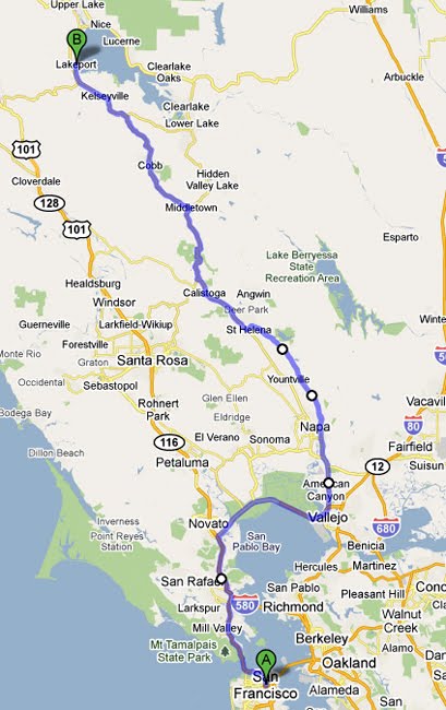
Our day started off by saying goodbye to Loren and Kate, they had a deadline to get their rental bike back to Richmond. The Brits too; David, Brenda, Lucy and Henry left as well, only the day after finally getting the second chase van replaced with one that actually started. We set off to Deals Gap to ride a particularly twisted section of US 129: 318 curves in 11 miles. Not long after we took off, we stopped and turned around to find Michael stopped with some clutch problem. We left him in the care of Rob and Scott in the other chase van, and headed towards Deals Gap.

We stopped at the Deals Gap Motorcycle Resort after a few turns in for a souvenir stop and for the amusement of the Tree of Shame. This clearly is the destination for all two wheeled vehicles, and the tree is for all those bits and pieces of bikes that split up upon impact with a tree or ditch.

The actual 11 miles of twists and turns is not much different than some of the twisties we've experienced, but just bunched closer together. The speed limit is 30 mph, and one TN State Trooper had a couple of crotch rockets on the side of the road in handcuffs. I felt no need to set any speed records, and surprisingly spent most of the time with no cars or bikes in sight.

The highlight of the day for me was the baby bear on the side of the road on the Dragon's Tail. At first, it looked like a fake bear with his paw lifted, ready to cross the road. My brain quickly connected there were no tacky lawn ornaments on this highway. I slowed down, he broke his steely pose, turned back and ran back in the woods.

We wound up driving back through Marysville to get Jonathan and Sheryl with the sidecar to the Harley dealership. Last night he had a fouled plug and was driving on one cylinder. I gave him a wire brush for the plug and thought the matter was fixed. It wasn't and off we went. This dealership is truly a destination upon itself. Out back there was an outdoor stage with a covered patio, a BBQ shack serving fresh pulled pork sandwiches from the huge hot smoker next to the stage. It was a welcomed respite, even if the bad news about Jonathan's ignition not being manufactured anymore was the source of his problems. No worries however, he rented a bike, several folks shifted two-up and we continued our journey.

We rode towards the Cherohala Skyway, through the Cherokee National Forest towards our final destination of the day: Dahlonega, GA where the Eastern Gold Rush began. I have to say the Cherohala Skyway was one of the most enjoyable rides this entire week. Just the right mix of trees and mountains and curves and streams and vistas.

We got the hotel late, Rob and Scott has scoped out a dinner spot willing to stay open late for us. The Crimson Moon Cafe served up a delectable shrimp and grits, and I saw several other tasty dishes go by. The huge slice of carrot cake Dennis ordered didn't look too shabby either. An acoustic duo was finishing up their last set. We broke out in guffaws when they broke into the the Lumberjack song from Monty Python. The other diners still left at the other tables I guess had never heard the song. More kazoos cheered up the remaining diners and wait staff.

Today's short slide show:

Wednesday, August 5, 2009

Day 7 - 222 Miles


We shot down I-75 towards Gatlinburg and took a detour through Cades Cove. Its a massive glen atop the mountains. A loop road winds through the park that once was a community. Several old churches and cabins dot the edge of the one way loop through the lush dell atop the Smoky Mountains. The loop road was rough in places, and my cooling fan came on for way too long waiting for the traffic jams. Although the signs clearly request one not to stop on the road for photos, but to use the numerous pulloffs, that didn't seem to faze the several van loads of kids that stopped at nearly every turn. I can't imagine how crowded this must be on a weekend. It did give me ample time to consider what living atop this mountain in the lush green valley would have been like to the early settlers. Several deer sightings as well as a bear crossing the road were the lead causes of the traffic jams.

We did catch a glimpse back on Hwy 321 of three elk munching in a small field by the road on our way to Gatlinburg. We had a late lunch a the first place we found: Smokey's Sports Pub and Grub. They were nice to accomodate the mess of us so late in the day. Some anonymous benefactor picked up the tab for lunch. My bet it was Jonathan. Thanks for the grub, it was tasty after that loop through the cove.

It was so late in the day, we decided to skip the hike a Clingman's Dome and head to Mingus Mill off Hwy 441. We got there just after they closed up for the day, but the outside and the machinery leading to the still working mill was fascinating. I followed the sluice upstream aways, and crossed the stream into the lush forrest. The mist hanging in the air was thick and cool.

Our last leg took us on Hwy 74 to Bryson City for the night. We found Mickey's Pub downtown. It was a gathering place for locals that also welcomed outsiders like ourselves. The bar was covered with brassieres stapled to the wooden structure. After several adult carbonated beverages, Alice, Shelly, and Kacey decided to leave their mark on the bar like so many before them. The bartender had the staple gun ready to go behind the bar, and up all four of them went, standing on the bar. The locals seemed to get a kick as well from the shenanigans.

Todays slide show.

Tuesday, August 4, 2009

Day 6 - 245 miles

Most of us managed to get to Melaine's in downtown Boone for breakfast. The Eggs Benedict were delicious, and it seems everyone else had a tasty breakfast as well. Our first stop was the Mast General Store in Valle Crusis. I can spend hours in a Lowes or Home Depot, I could spend a week in this old timey blast from the past. The smells and sights are inviting as the candy counter next to the homemade jams and jellies. The clothing and crafts section, as well as the hardware selection really make one feel like they have stepped back in time.

We left Valle Crusis headed towards Roan Mountain State Park in Tennessee. More winding roads lead us higher and higher where the clouds hanging over the mountain tops clung in the valleys. We missed the turn off and drove to the other side of the mountain before turning back and heading up again. Funny enough the parking area at the top was named Cloudview somethingorother. We were totally socked in by clouds swirling around us. Didn't seem to bother the several families grilling out in the parking lot. More kazoos for the kids. Needless to say, we skipped the hike in the park.

We shot on over to Johnson City, TN for lunch before departing for Cumberland Gap. Unfortunately, the skies did not cooperate and the light rain we encountered leaving town turned worse and worse as we got wetter and wetter. After stopping for a particularly heavy downpour with lightning all around us, we decided to head straight to our hotel in Corbin, KY.

After drying off a bit, a Mexican Dinner at El Ranchero was a welcome respite. Even more so since Bill picked up the tab. I expecting a discount, but this was over the top. Thanks Bill.

We were due for freshly baked pie for desert at Moe and Christina's house ( how do they manage to cook and plan these rides is beyond me ) before heading to Cumberland Falls to witness a moonbow: a rainbow in the mist from the light of the moon. Unfortunately, we 'll only get to enjoy pictures, as the clouds did not cooperate. However the pie was to die for. Rhubarb, Cherry, Apple, and Lemonade pie was a treat as well. Thanks Christine.

A short slide show. Laundry time...